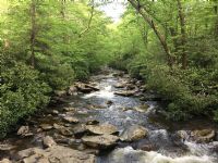
![]() |
| Dam Name: | South Holston |
| Other Name: | South Holston Lake |
| NID ID: | TN16305 |
| Longitude: | -82.08 |
| Latitude: | 36.52 |
| County: | Sullivan |
| River: | South Fork Holston River |
| State: | TN |
| Nearest City: | Bluff City |
| Distance: | 15.00 miles |
| Own_name Name: | TVA |
| Owner Type: | FEDERAL |
| Dam Designer: | TVA |
| Private Dam? | NO |
| Dam Type: | Rockfill Earth |
| Core: | Earth (Type) |
| Foundation: | S |
| Purposes: | Flood Control and Storm Water Mgmt Hydroelectric Navigation Recreation |
| Year Completed: | 1950 |
| Dam Length: | 1600.00 feet |
| Maximum Discharge: | 62000 cu ft/sec |
| Maximum Storage: | 764000 acre-feet |
| Normal Storage: | 325700 acre-feet |
| Surface Area: | 4860 acres |
| Drainage Area: | 703 square miles |
| Hazard Potential: | HIGH |
| Emergency Action Plan? | YES |
| Inspection Date: | 1/22/1997 |
| Inspection Frequency: | 5.00 |
| State Regulated Dam? | NO |
| Spillway Type: | UNCONTROLLED |
| Spillway Width: | 385.00 feet |
| Outlet Gates: | Morning Glory / Sluiceway |
| Number of Locks: | 0.00 |
| Federal Funding Agency: | |
| Federal Design Agency: | Tennessee Valley Authority |
| Federal Construction Agency: | Tennessee Valley Authority |
| Federal Regulatory Agency: | |
| Federal Inspection Agency: | Tennessee Valley Authority |
| Federal Operating Agency: | Tennessee Valley Authority |
| Federal Owner (Agency): | Tennessee Valley Authority |
| Other Federal Agencies: | |
| Source Agency: | Tennessee Valley Authority |
|